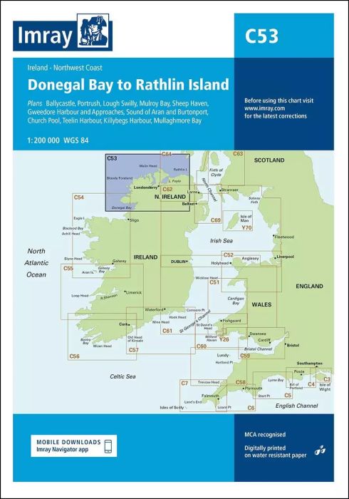
Plans included:
Ballycastle (1:5000)
Portrush (1:15 000)
Lough Swilly (1:45 000)
Mulroy Bay (1:30 000)
Sheep Haven (1:30 000)
Gweedore Harbour and Approaches (1:40 000)
Sound of Aran and Burtonport (1:30 000)
Church Pool (1:20 000)
Teelin Harbour (1:10 000)
Killybegs Harbour (1:12 500)
Mullaghmore Bay (1:50 000)
On this edition the chart specification has been improved to show coloured light flashes. Depths have been updated from the latest surveys where available. New plans of Ballycastle and Church Pool are now included. There has been general updating throughout.
| Artikelnummer | BD2864 |
|---|---|
| Artikelname | C53 Donegal Bay to Rathlin Island |
| ISBN | 9781786790583 |
| EAN | 9781786790583 |
| Hersteller / Verlag | Imray |
| Rückgaberecht | Gemäss unseren AGBs |
| Produkttyp | Karte |
| Medium / Produktart | Papier |
| Kategorien | Seekarte/Binnenkarte |
| Sprache | Englisch |
| Land / Region | Irland |
| Gewässer | Atlantischer Ozean |
| Erscheinungsjahr | 2018 |
| Aktualisiert | 2023 |
| Ausführung | Gefaltet, in Plastikmappe |
| Massstab | 1:200'000 |
| Kartentyp | 1:30'000 bis 1:300'000 |
| Kartenlänge offen (cm) | 78,7 |
| Kartenbreite offen (cm) | 111,8 |
| Gewicht (kg) | 0.13 |
| Dimension 1 (cm) | 33 |
| Dimension 2 (cm) | 24 |
Schreibe eine Bewertung
Für dich empfohlene Produkte!


Validate your login
Anmelden
Neuen Account erstellen